15 NANCY LN
Owner Information
ZHONG, BILLY & KAY THET .
15 NANCY LN.
WALTHAM, MA 02452


Property Details
15 NANCY LN is classified as a Single Family Residential (Colonial).
The primary structure on this property was built in 1986. There are 1,802ft2 of built area within this property. There is 1,802ft2 of residential/living space within this property. This property is listed as having 8 rooms.
15 NANCY LN is valued at $665,200. The land is valued at $335,600 and the structures are valued at $329,600.
The most recent deed for 15 NANCY LN is recorded at the local registrar in Book 1502, Page 33. 15 NANCY LN was last sold on Friday, December 23, 2016 for $1.
Assessment data from fiscal year 2022.
Flood Data
According to the FEMA National Flood Hazard Layer, this property does not appear to be in a flood zone. It may also be in an area not yet reviewed. Nonetheless, confirm this information prior to taking any action.
To view the flood hazards around this property, create a FEMA "Firmette" Map of the area around 15 NANCY LN.
Broadband Internet Providers
| Provider | Type | Bandwidth (mbps) | |
|---|---|---|---|
| T-Mobile | Fixed Wireless | 25 | 3 |
| GCI Communication Corp. | Satellite | 0 | 0 |
| HughesNet | Satellite | 25 | 3 |
| VSAT Systems, LLC. | Satellite | 2 | 1 |
| Viasat Inc | Satellite | 100 | 3 |
| Comcast | Cable | 1000 | 35 |
Broadband service provider data from December 2020.
Adjacent Properties
- 17 NANCY LN
Single Family Residential owned by FENG, BO & LIPING LUO - 5 NANCY LN
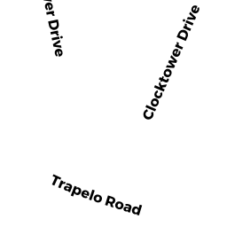
Single Family Residential owned by ZHENG, MOLI & BINHUI WANG & - 957 TRAPELO RD
Single Family Residential owned by 957 TRAPELO RD. NOM. TRUST; - 6 BOW ST
Single Family Residential owned by SHAHBAZYAN, HOVHANNES & - 16 BOW ST
Single Family Residential owned by LORRAINE FERRARA CENTOLA RLTY.